

Kanagawa / 神奈川県 · Prefecture #6
Kamakura is a super chill coastal town just south of Tokyo, like a mini escape from the big-city vibe. It has a cool mix of old-school Japan and surf-town energy: ancient temples and hiking trails, and right around the corner, a beach with people walking their dogs and riding waves.
I needed an easy hike after our strenuous Mt. Nantai hike the week before, so we went to Kamakura and hiked the Tenen Trail. The weather was perfect for a quick, easy day hike: not too hot, not too windy.
There are lots of trails to choose from in the Kamakura Alps, and both routes I've done (the Daibutsu Trail and the Tenen Trail) are great for beginners. Of the two, I like the Tenen Trail better, because it goes to the highest point in Kamakura, Ohirayama / 大平山 (159.2 m). The hike was super fun and easy.
📑 Table of Contents ▾ tap to open
HIKE LOG :
May 05, 2025 / Kanagawa Prefecture
May 05, 2025 / Kanagawa Prefecture
Tenen Hiking Course · Mt. Ohirayama / 大平山 (159.2 m), the highest point in Kamakura
Start Kencho-ji / 建長寺 (from Kita-Kamakura Station)
Summit Mt. Ohirayama / 大平山 (159.2 m)
Goal Kamakura-gū / 鎌倉宮
Total 2 h 31 min (09:44-12:15)
Distance 5.2 km (plus about 1 km from Kita-Kamakura Station to Kencho-ji) Up 226 m
YAMAP LINK : HERE
MAP

ELEVATION PROFILE

For the hike itself, use YAMAP. Download the map offline before you go.
TENEN HIKING COURSE / 天園ハイキングコース

There's no proper summit marker for this peak (just a wooden board with the name and elevation), and I heard some locals commenting about it, but we didn't mind.
We met at Kita-Kamakura Station around 9:00 and tried to find the start of the hike, because I'd messed up my saved maps on YAMAP. I didn't see any signs, same as when I did the Daibutsu Trail before, so I just used Google Maps to find the trailhead.
If you're starting from Kita-Kamakura, leave the station (either exit is fine, but the east exit is closer) and use Google Maps to get to Kencho-ji. From there, I used YAMAP.
I'd still download the offline map, because the trail splits in places and I had to check my map to know which way to go. At one spot in particular, someone commented on YAMAP that it's easy to get lost if you go the other way.

Kencho-ji entrance / 建長寺入口
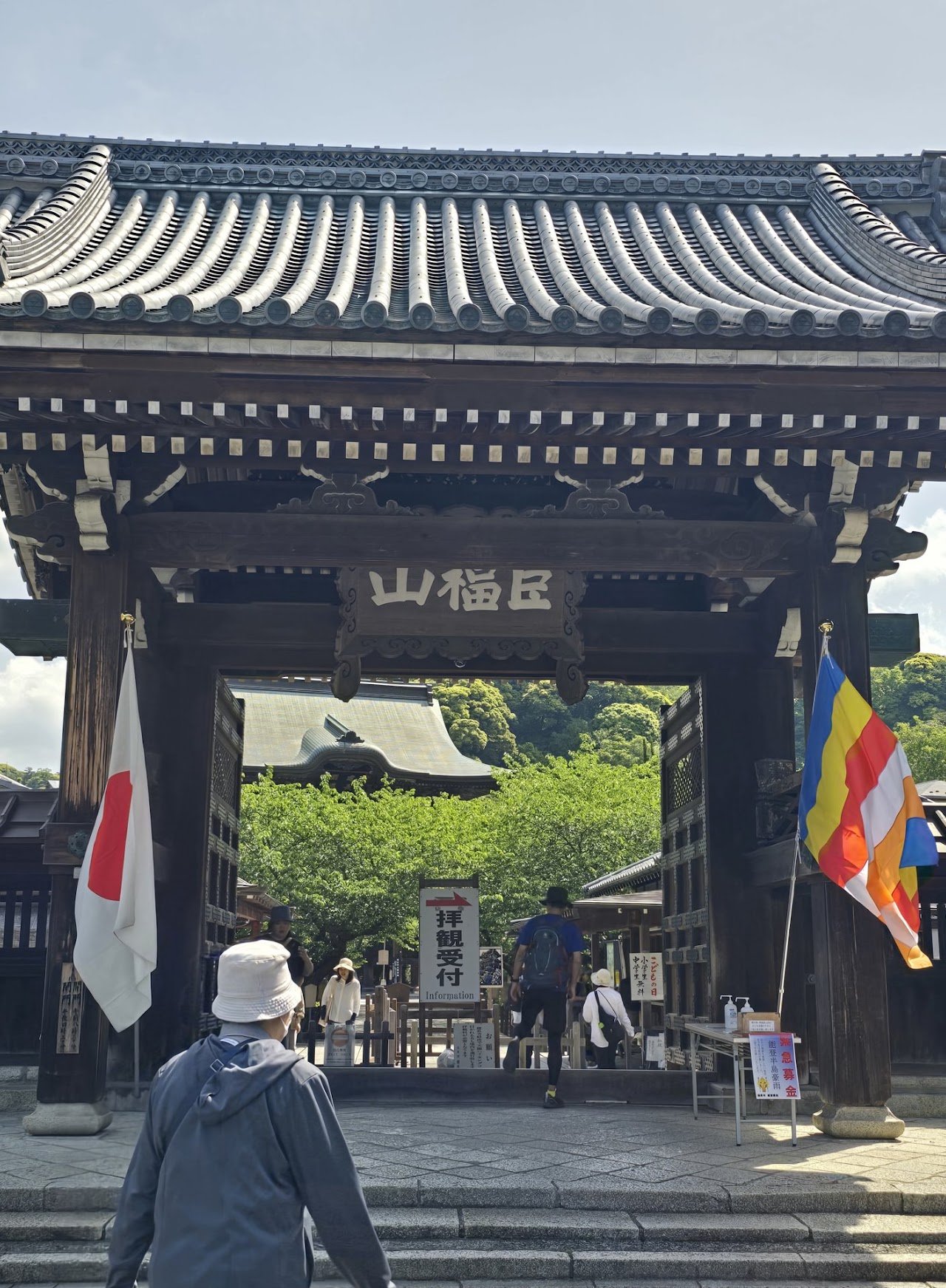
On your left, you'll see the Somon / 総門.
Enter through the Somon / 総門 on your left, and you'll see the temple reception on your left. I was confused at first because the kanji isn't the same, but this is the entrance.
We paid ¥500 each at reception and got a brochure. You'll see a map of the temple; go to Hanso-bo / 半僧坊 to find the trailhead for the Tenen Trail.

Apparently the garden here is nice, but what I assumed was the garden gate was closed, so I didn't think you could go in that day. If you really want to see it, ask at reception, because I'm not sure where the garden entrance is.

I thought this was the entrance and that it was closed. There was a path on the left side, and we just followed that.

After you see this marker, the way is pretty easy to follow.
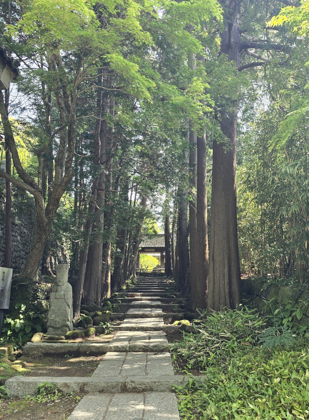
A nice path, but not the way to go.
The first part, what seemed like an endless flight of stairs, was the hardest for me. But the view is nice, I promise, it's worth it.

The trail leads you to a flight of cement stairs up to Hansobo Shrine. Along the path are 12 statues of tough-looking tengu in different poses. Tengu are legendary goblin-like creatures that live in the mountains, usually depicted with either long noses or beaks and wings. The ones at Hansobo are the latter, karasu (crow) tengu. They're attendants of Hansobo, whose main role is to protect Kencho-ji from fire. Hansobo is believed to have this power because his statue escaped harm when Hoko-ji Temple caught fire.
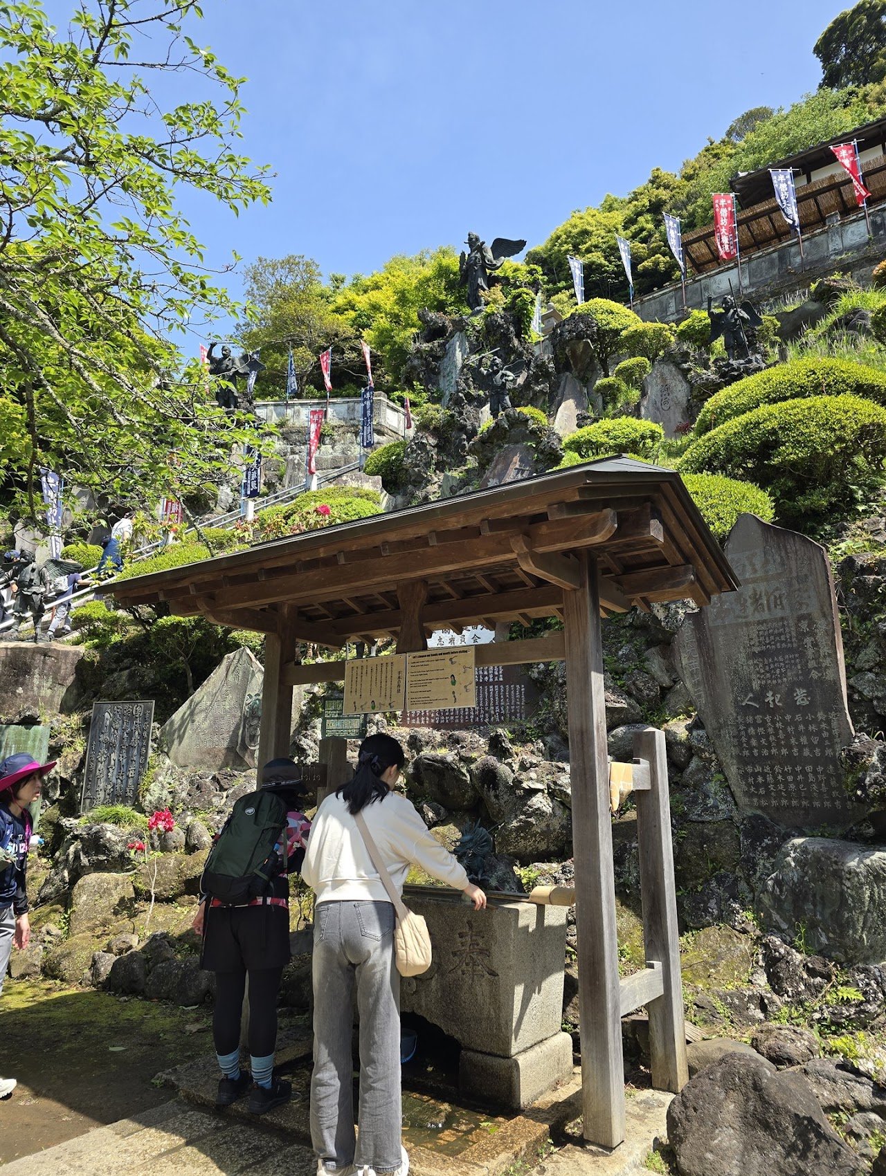
After all the stairs, it's a pretty chill hike once you reach the last set of stairs with the big tengu statue and the Mt. Fuji viewpoint.

After that, we just followed the Tenen Trail markers, and when I wasn't sure, I checked YAMAP. We crossed a bridge before reaching the Ohirayama peak.

11:00 – We finally reached the highest peak in Kamakura and took a quick lunch break before starting our descent at 11:20.
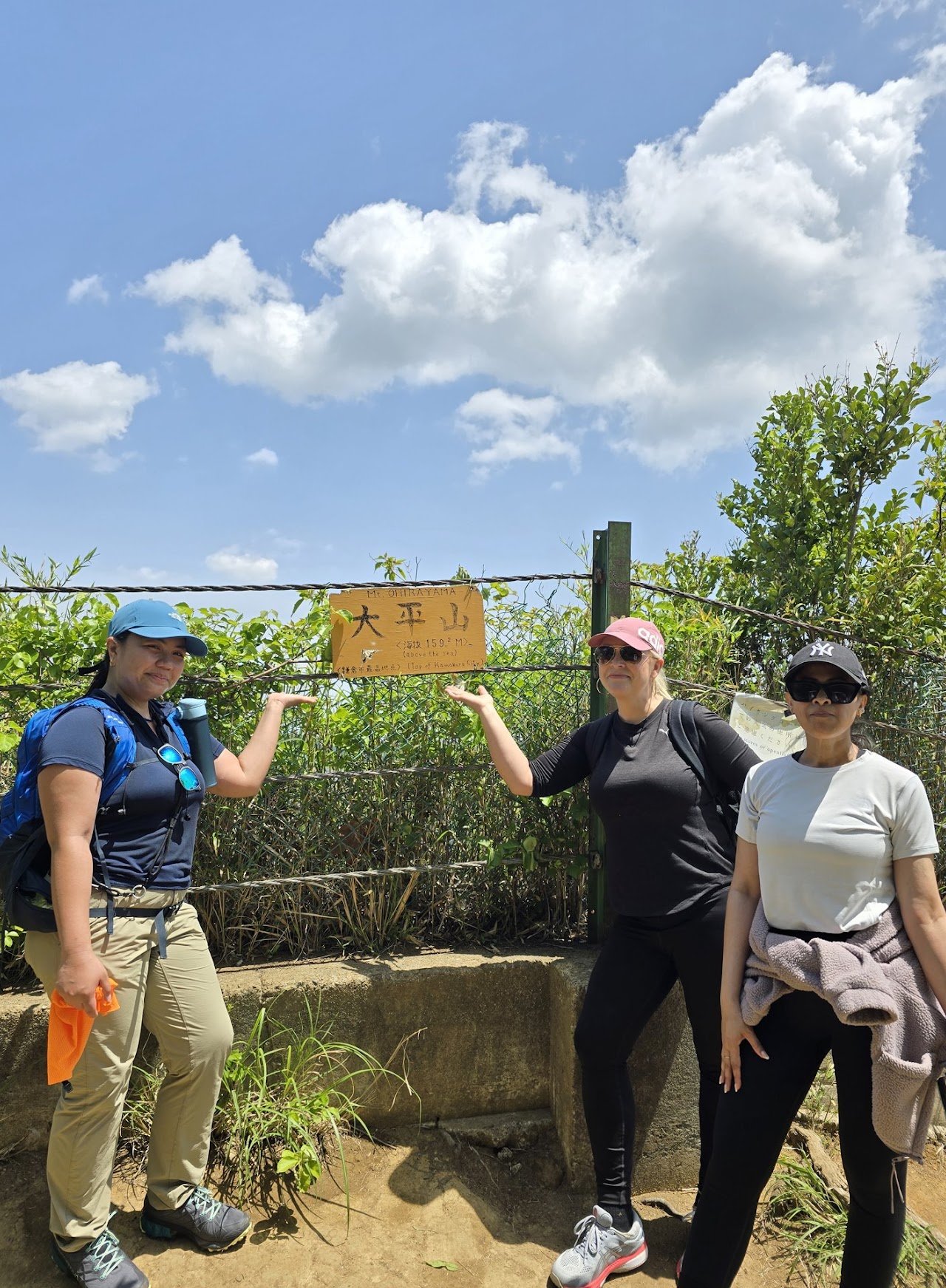
Our crew today: me (Mari), Lucinda and Paro :)

We looked for the Tenen marker but couldn't find it, even though our map said we were there. From "Tenen", the trail splits two ways, toward Shishimai-no-Tani and toward Zuisen-ji, and we chose Zuisen-ji because it's shorter.
The descent was so nice, but it's a bit confusing where it ends, because you come out in a residential area. After we reached Zuisen-ji, we got hungry and wandered around looking for restaurants, and ended up at the Grand Torii.
12:15 – We ended our hike at the Grand Torii near Kamakura-gu. Kamakura-gu was built around the cave where the 14th-century Japanese prince and monk Prince Moriyoshi (1308 – August 12, 1335) was imprisoned for 9 months before he was beheaded (a common execution method for political prisoners at the time) that August. Emperor Meiji dedicated the shrine to him in 1869.

The Grand Torii
Apparently, there's an "altar" inside where you can make a donation and get a tiny symbolic sakazuki (sake cup). You blow your troubles into it and smash it on a nearby rock, and the god of dissolving troubles relieves you of your burden. Make sure the cup breaks, though; if not, repeat until it does.
There's also a turtle statue, and it's believed that petting it can improve your health.

After our hike, we rewarded ourselves with soba at a nearby restaurant.

My original hiking plan that didn't go well :P
DAIBUTSU HIKING COURSE / 大仏ハイキングコース
HIKE LOG :
Dec 03, 2024 / Kanagawa Prefecture
Dec 03, 2024 / Kanagawa Prefecture
Kuzuharaoka–Daibutsu Hiking Course / 葛原岡・大仏ハイキングコース


Another option is the Kuzuharaoka–Daibutsu Hiking Course. I hiked this trail back in December, and the autumn leaves were on point. It's easy to reach from JR Kita-Kamakura Station. I recommend going by train instead of by car like we did, because it's a point-to-point hike, meaning it starts at one trailhead and ends at another.
If you do go by car, there are lots of paid parking lots near the station. We parked HERE, near the Lawson Three F convenience store.
First, we had coffee at Verve. I really like the ambience there; it's very relaxing. We sat outside and just enjoyed our cute coffees. The staff were so nice too.

14:00 – We started our hike from Jochi-ji / 浄智寺, where the laughing Buddha (Hotei-son) is. We didn't go inside because we started pretty late, so we'll save the temples for next time.

I wouldn't hike here without YAMAP, because the trail isn't well marked. It's kind of confusing which way to go, so I just followed my map. When in doubt, look for markers like these…


But some parts look like this, so definitely have a map.
We didn't know where to go after this, so we followed the map and eventually saw a sign for the Daibutsu Trail.
We passed an abandoned building, which was kind of creepy.

I panicked a little after the abandoned building because the signs got confusing, but nearby you'll see this. I think this is where we got lost, so when I saw this sign, I just followed the Daibutsu Course / 大仏コース. In my head, the goal was just to get to Kotoku-in, where the Great Buddha is.
Left: Mineyama, Kajiwara-guchi / 峰山 梶原口
Right: Kikyoyama, Daibutsu Course / 桔梗山 大仏コース

There's no romaji, so you just have to remember the kanji.
Apparently we passed Mineyama (98 m) and Kikyoyama (113 m), but I didn't see any markers. Someone on YAMAP posted pictures of them, though.
After surviving the haunted building, you'll see a nice park called Mineyama / 峯山.

I guess I passed the marker, but it was too small for me to notice.
Then we got lost, because we left the trail and came out onto the road, and I almost missed this sign because I'm too short to see it.

We got back on the Daibutsu Trail by following this sign.

15:55 – We finally reached Kotoku-in after almost 3 hours. Good job, self!

Apparently you can see inside the Buddha because it's hollow, and I didn't know that at the time.
I think we made a mistake with this route, so I wouldn't recommend it. I had a hard time finding a model course on YAMAP for the Daibutsu Trail, so I made one. I think it's much better to go straight from Kikyoyama to Kotoku-in without passing Mineyama like we did.
RECOMMENDED MAP
Check this website for a better map of all the trails.
Thank you, as always, for following my adventures!
Watch the videos on YouTube @marigoroundofficial and say hi on Instagram @marigoroundofficial.
EAT, SLEEP, HIKE, REPEAT =)
#MariGoRound