

Tochigi / 栃木県 · Prefecture #11
Oops, I did it again…
Someone told me Nantai is easier than Shirane, so I thought, "Oh, maybe it won't be so bad. I got this." WRONG. Hikemaster rated this hike 3/5, but for me it was more like 10/5. Haha! I was dying on the trail… for real. I think it's the hardest mountain I've ever hiked.
I'd taken a long break from hiking and went from zero to full-on crazy, taking on a steep Goliath of a mountain like Mt. Nantai (2,486 m). My legs hated me for days after. I did every post-hike recovery tip ChatGPT suggested: gentle massage, alternating hot and cold baths, stretching, the foam roller as my best friend all day, you name it. I did it all just to recover faster from sore muscles.
It was so hard to go up and down stairs for 3 days. My colleagues were looking at me funny; it was embarrassing. To give you an idea…

The circled parts are where I had the hardest time.
The steep ascent was hard, and the trail around the big rocks was too much for my short legs. And don't get me started on the descent, because I've never experienced one like that. I was wondering if rolling down would be better than walking sideways.
But I think if I'd prepared more before this hike (maybe by hiking a few lower mountains first), my experience would've been different. Another lesson learned: don't overestimate yourself.
Let me walk you through it.
📑 Table of Contents ▾ tap to open
HIKE LOG :
Apr 27, 2025 / Tochigi Prefecture
Apr 27, 2025 / Tochigi Prefecture
Mt. Nantai / 男体山 (2,486 m) · ☆ One of the 100 Famous Mountains of Japan
Start Futarasan Shrine Chūgūshi / 二荒山神社中宮祠 (about 1,270 m)
Summit Mt. Nantai / 男体山 (2,486 m)
Goal Futarasan Shrine Chūgūshi / 二荒山神社中宮祠 (about 1,270 m)
Ascent 4 h 49 min (07:11-12:00)
Summit break 1 h 10 min (12:00-13:10)
Descent 3 h 40 min (13:10-16:50)
Distance 8.2 km Up 1,179 m
YAMAP LINK : HERE
MAP

ELEVATION PROFILE

For the hike itself, use YAMAP. Download the map offline before you go.
GEAR
What I packed : My usual Day Hike Pack
Water : 1 L + 2 energy jellies
TIMELINE
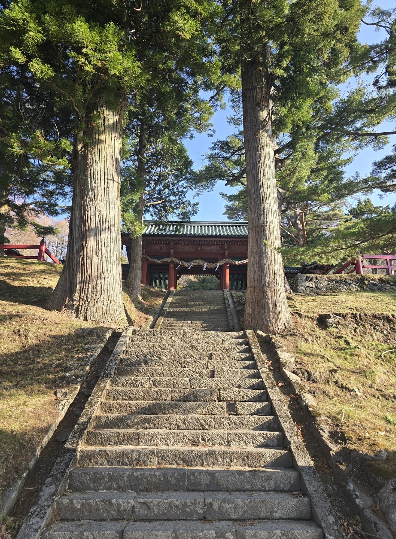
6:45 – We reached the parking lot and got ready. We were already behind schedule, since we'd planned to start at 6:00. There's no bathroom at the summit, so use the toilet near the parking lot before you enter the shrine.
We paid ¥1,000 each at the shrine to enter and got a white omamori that you can keep. We entered the shrine gates at 7:00, and the trail started with concrete stairs, so naturally it ends with, guess what, stairs, just worse, because you're going down.
Please note: since it's a 6–7 hour round trip, they won't let you through after 12:00.


The hike was steep right off the bat, no easing you in or anything. There were stairs after the shrine gate and then BAM, immediate regret. I shouldn't have bothered bringing my fleece jacket since it wasn't that cold; at least my pack would've been lighter and less bulky. I didn't even have time to go through stages 1 or 2 of hiker's regret; I went straight to 6.
For a while, I didn't enjoy this part, because all I saw were dry leaves and no good views. Spring had just started, so the forest looked dry.


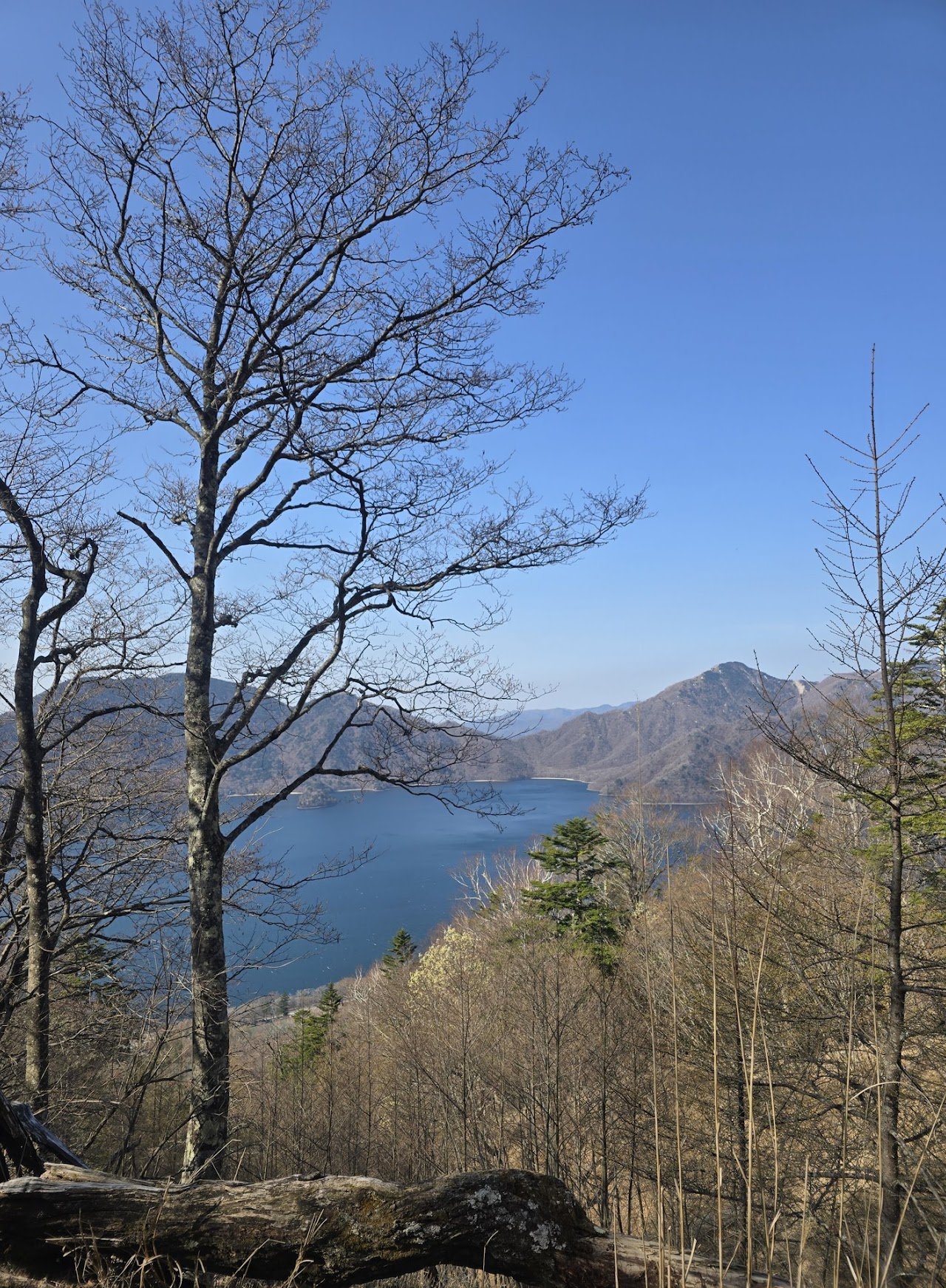
8:00 – After about an hour of steep climbing, you finally start seeing good views.
8:20 – We reached another torii gate marking the trail entrance / 登山道入口 (tozandō iriguchi).

Everything after this torii gate was a blur. All I know is IT WAS A STRUGGLE getting up the rocks, snow and melting ice (the most dangerous, because it's so slippery). Good thing we brought microspikes, because I don't think I could've climbed without them.
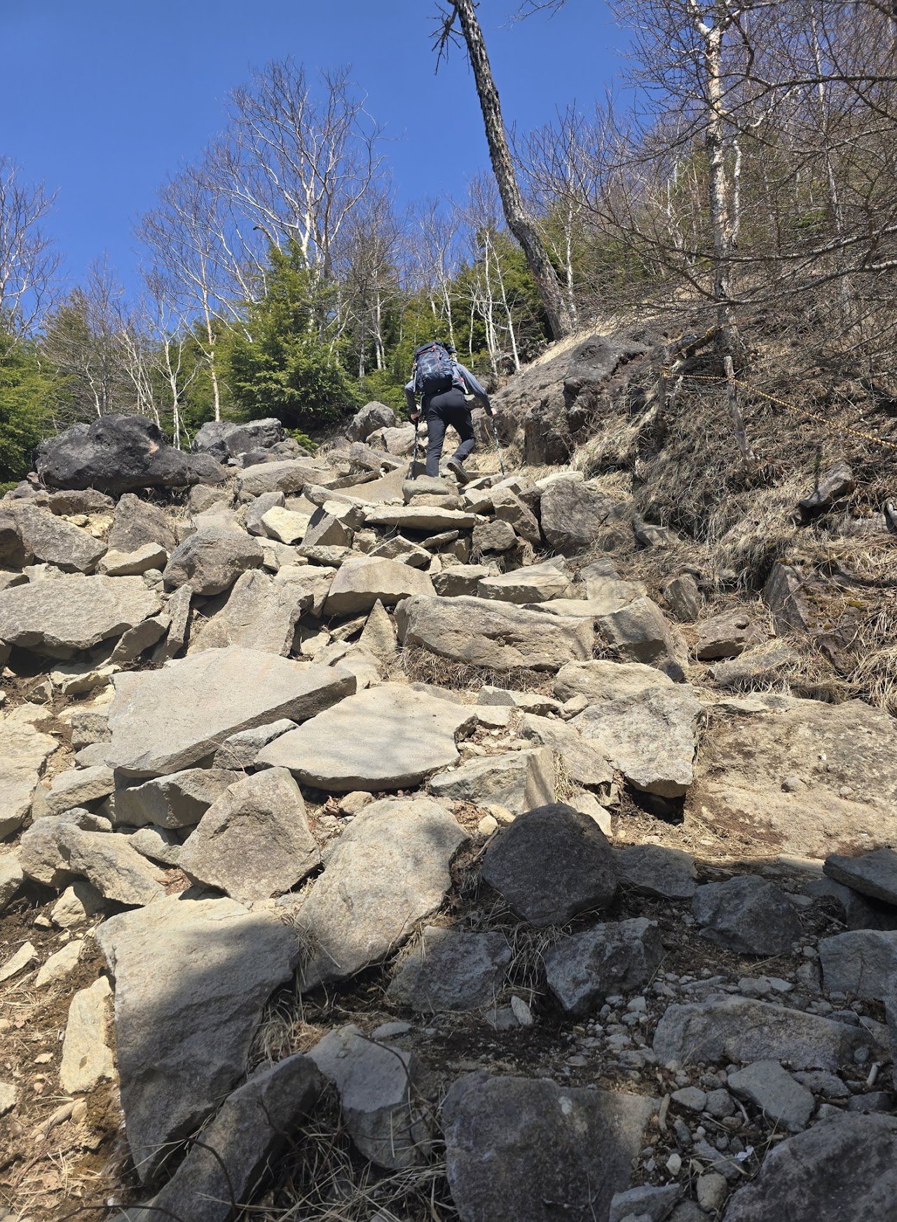
If you had a hard time going up, it's going to be harder going down.

See how steep that is? Regret level 999999. My only comfort was counting the station markers from 3 to 9, because I knew the summit comes after 9. Even then, I started questioning my life choices after the 8th station.
But it was too late to turn back, because then I'd have to do it all over again for a revenge hike, and frankly, I don't think I want to hike this mountain again… okay, maybe one more time in autumn, BUT THAT'S IT.
Just before the summit, there's a viewpoint that I actually liked better, because it's open and you can see Lake Chuzenji and the snowy mountains in the background.

The picture doesn't do it justice. It was ten thousand times more beautiful.
12:00 – I FINALLY REACHED THE SUMMIT. YAY! The hard part was over. WRONG AGAIN.
Our friends were freezing, because they'd gotten there hours before me. The first one even arrived at 9:30. What a beast. We boiled water for our ramen, and life was good again.

After eating, we had our photoshoot, which lasted about an hour. As for me, I was taking my sweet time just to avoid going down, because I knew it was going to be a pain in the a**.

My current favorite summit shot. Thanks for taking this, Yvan!

Today's crew: Ken, Roberto, Yvan, Liana, Marc, me (Mari) and Jick
13:10 – We left the summit and did it all in reverse. At first I thought, okay, I think I've got this, but after the 5th station I was like, are we there yet?
We eventually reached the bottom, and it took everything in me not to roll down the stairs just to get it over with.

16:50 – Finally made it back to the trailhead in one piece. So grateful!
THINGS I LEARNED FROM THIS HIKE
I should've used a trail running pack instead (my Salomon one that hugs your back), because the trail has a rocky section with large boulders, and a bulky pack makes them harder to climb.
I only brought 1 L of water and 2 energy jellies. It was warm that day, and that wasn't enough.
The forecast was sunny/cloudy (-6 to 8°C), so I brought my fleece jacket AND a rain jacket/windbreaker, but I didn't use the fleece at all. I should've left it in the car.
Again, I should've done Mt. Takao or Mt. Mitake the week before Mt. Nantai. I think it would've made a difference, especially for a beginner like me.
I forgot my other gloves, the summer ones with better grip. I only brought my liner gloves, which weren't suitable for the rocky section.
Was it hard? YES
Did I think I was gonna die? YES
But did I actually die? NO
Do I wanna hike again? HELL YES. In fact, I was already planning my next hike after resting for a whole day.
Am I addicted? YES, I'm highly positive I'm crazy… yama-crazy.
We organize beginner/intermediate hikes in the Kanto area, and joiners are always welcome, so feel free to send me a message if you want to join us.
Thank you, as always, for following my adventures!
Watch the videos on YouTube @marigoroundofficial and say hi on Instagram @marigoroundofficial.
EAT, SLEEP, HIKE, REPEAT =)
#MariGoRound