

Kanagawa / 神奈川県 · Prefecture #6
Mt. Oyama (1,252 m) is very popular with locals, mainly because of Oyama Afuri Shrine. The shrine's history is said to go back more than 2,200 years, and it's been a well-known pilgrimage spot since the mid-18th century, during the Edo period (1603–1868).
There are multiple trailheads and plenty of routes to choose from depending on your level. The mountain is open all year round, but there are no huts or campsites, so overnight hiking isn't recommended.
Want a route with less climbing? Read my newer post, Mt. Oyama via Yabitsu Pass, where we took the bus up to Yabitsu Pass (761 m).
📑 Table of Contents ▾ tap to open
HIKE LOG :
Nov 17, 2024 / Kanagawa Prefecture
Nov 17, 2024 / Kanagawa Prefecture
Mt. Oyama / 大山 (1,252 m)
Start Oyama Cable bus stop / 大山ケーブル (via Koma-sando)
Summit Mt. Oyama / 大山 (1,252 m)
Goal Oyama Cable bus stop / 大山ケーブル (down via Miharashidai)
Ascent 3 h 17 min (08:18-11:35)
Summit break 1 h 00 min (11:35-12:35)
Descent 3 h 02 min (12:35-15:37)
Distance 8.4 km Up 937 m Down 937 m
YAMAP LINK : HERE
MAP

ELEVATION PROFILE

For the hike itself, use YAMAP. Download the map offline before you go.
GEAR
What I packed : My usual Day Hike Pack
Backpack Weight : 5 kg
Water : 1.5 L (hydration reservoir, Platypus Big Zip EVO) + a 500 ml PET bottle of electrolytes
TIMELINE
NOV 17, 2024 (Sun) – We left Yokosuka around 6:00 and got to this parking lot around 7:15. There's a big toilet near the parking lot, and the bus stop is nearby too.
Good thing we got there early, because there were only four spaces left when we arrived, and the last one got taken just before my friend Sonia got there at 7:40. They had to look for another spot since all the nearby ones were full. Eventually they found one further away and walked all the way to the Oyama Information Center, our meeting place.
Some of us took the bus from Isehara Station to Oyama Cable Car bus stop. (Google Maps said to get off at another stop and walk, but the right stop is the last one.)
8:15 – We started walking toward the Koma-sando approach. The Google Maps pin was wrong, so I didn't include it, but it's just a few steps after you pass Oyamaafurijinjahoncho Aoki Church on your right, with a bridge on your left.
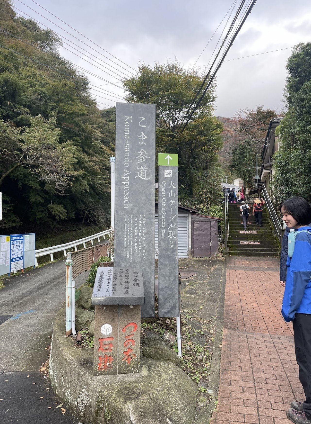
Koma-sando approach sign

You'll pass lots of food shops along Koma-sando Street, but I was told most of them open at 9:00.
So if you're starting your hike early, bring food, especially if, like us, you eat breakfast on the trail.

You'll see the Oyama Cable Car Station on your right a little after this marker.

The way to Oyama Cable Car Station
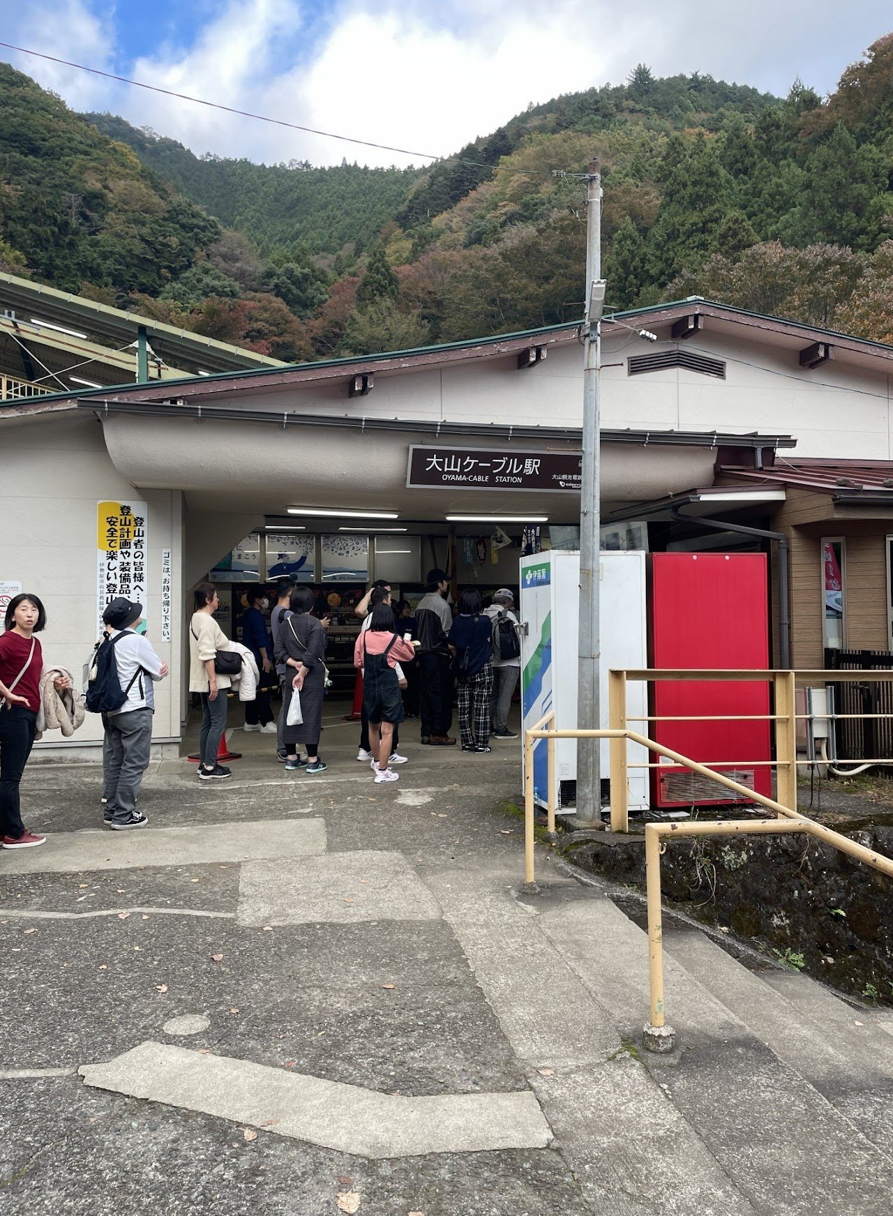
Inside this station is where you get the stamp for the Tanzawa Mountain Stamp Rally, if you want their collectible towels.
8:30 – After passing Oyama Cable Car Station, we reached the split where you choose between the Women's Trail / Onna-zaka / 女坂 and the Men's Trail / Otoko-zaka / 男坂.

We chose the Onna-zaka trail going up because they said it's the easier one.

Ojizo-sama, or Kṣitigarbha (in Sanskrit)
You'll also see some Ojizo-sama wearing red bibs along the trail. These childlike statues are found all over Japan, in temples, cemeteries and even along roadsides. Ojizo-sama represents Kṣitigarbha, one of Japan's most beloved divinities, known as the guardian of children, especially those who pass away before their parents, including the souls of stillborn, miscarried or aborted babies, who are honored through the ritual of mizuko kuyō.
The statues are sometimes surrounded by piles of stones and pebbles, placed there by people hoping to shorten the time children have to suffer in the underworld.
His statues are often made to look more baby-like, symbolizing the children he protects. They usually wear red bibs, which comes from Japanese folklore, where red is believed to drive away demons and illness. In Japan, red is associated with several deities in both Shinto and Buddhist traditions, and their statues are often dressed in red or painted red.

Some parts of the trail are stone steps like this.
8:45 – You'll see Ryujindo on the left and Oyamadera lodge on your right, but the lodge is closed now. It looked like an abandoned haunted temple.

Ryujindo
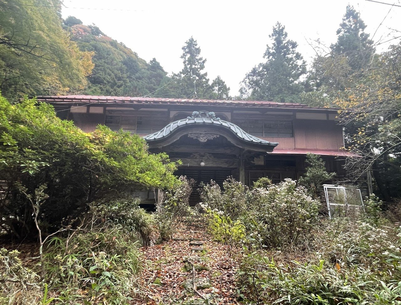
Oyamadera lodge
Then you climb more concrete stairs to reach Oyamadera (temple). I really like the stairs leading up to the temple.

At the top, you'll see Oyamadera Temple. Apparently, you can try a custom called kawarake nage here: throwing small ceramic plates off a cliff to ward off misfortune and invite good luck. We didn't try it because we just continued on the right path. I didn't check where the left path goes, so I'm not sure.

Then you'll see more stone steps (8:58 am).
9:25 – We reached the area with food stalls, cafes and a shop.

I bought my souvenir Tanzawa t-shirt and towel here. They have so many nice designs; I wanted to get them all.

T-shirts are ¥2,000.

More stairs…
9:40 – Until we finally reached Oyama Afuri Shrine. We saw lots of people in normal clothes, even a few in skirts and mid-heel shoes, but I'm pretty sure they took the cable car up to Afuri Jinja Station and skipped the dirt trail. You still have to walk up some steps, though, so I'm not sure that's the life you want to choose.
But hey, we even saw a guy hiking the dirt trail in geta, so some people really do choose to live on the edge. I was wearing proper hiking shoes, and I still slipped twice on the stone steps.
The view here was amazing, so even if you don't go all the way to the summit, I think this is a really good beginner-friendly course. Some people take the cable car up to this point and hike to the summit from here, which sounds like a pretty solid plan too.
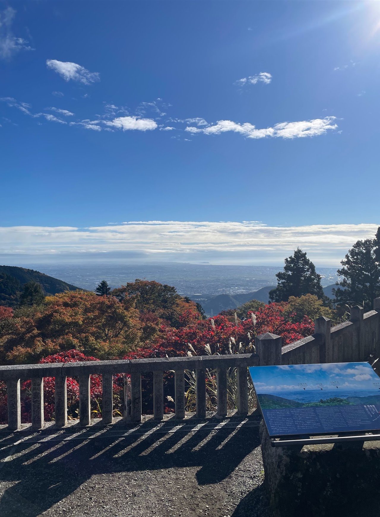
You can see Enoshima from here on a good day.

Statue of Naosuke Gonda


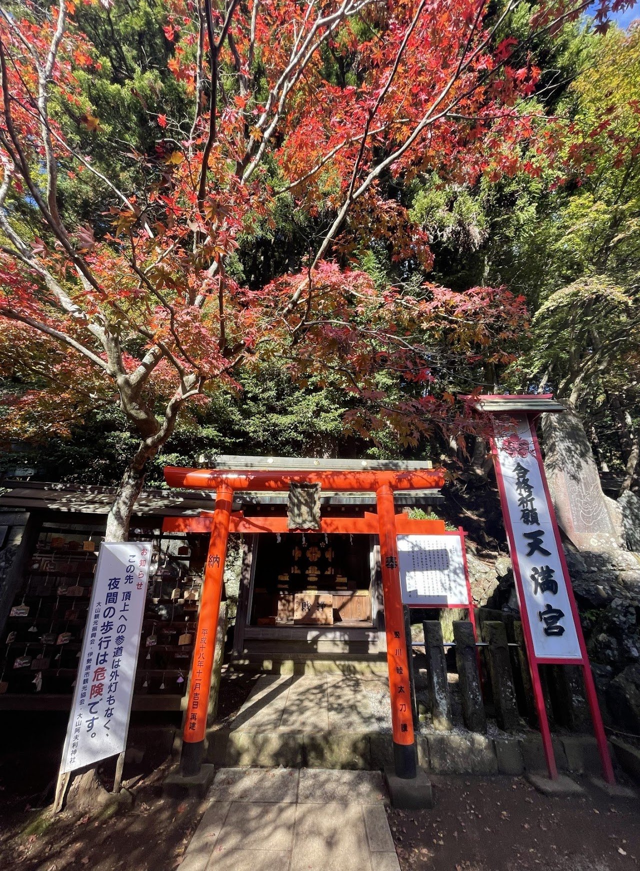
Sugawara no Michizane, the god of learning, is enshrined here.
The statue next to this shrine was put up on August 15, 1985, 40 years after the end of the war, to commemorate peace and freedom from life as evacuees after the war. The stone tablet also honors the souls of the students who died in the evacuation area.
We bought the booklet (¥500) for the Tanzawa Mountain stamp rally here. You can also get your goshuin here (I think it was about ¥500 too, but I'm not sure), and they sell omamori as well.
9:55 – After buying the booklet, we followed everyone to the entrance of the upper shrine. We paid ¥100, took the stick with white cloth, waved it left and right, and got a white paper. I lost mine, so I forgot what was written on it.

You'll see 28 of these markers on the way to the summit. Every Japanese kid we saw was counting them.


This tree has been around for about 500–600 years.


11:35 – We finally reached the summit of Mt. Oyama. Time for lunch!

I think you can buy things on the left after the steps, but I'm not sure because we brought our own food.

Me (Mari), Mami, Manny, Jovi, Rona, Sonia, Mike and their cute but very camera-shy pup Indica
There are lots of benches and tables to eat at, but there were also a lot of people, so some brought their own sheets to sit on. We didn't bring one, so we waited for others to finish eating.
The toilet had a long line and didn't smell very good. I ended up changing my top because I was sweating like crazy. I didn't sweat this much on our previous hikes, and those were much longer.
12:35 – For our descent, we went down via Miharashidai.

Go straight for the Miharashidai route, or right if you want to take the cable car.

Going down, it's mostly wooden boardwalk.


山岳安全 (sangaku anzen): safe trekking/hiking
I suggest using YAMAP for offline maps and planning your routes. It takes some getting used to, but after a few uses you'll get the hang of it. HERE is the route we took, and I uploaded some pictures too. Some people did it in reverse, and there are honestly lots of different routes you can do here.
Two of us got lost toward the end and separated from the group, because I was looking for Oyama Cable Car Station (for the stamp) and accidentally went to Oyamadera Station (the one in the middle) instead. The rest of the group waited for us at Oyamadera lodge.
I also forgot to end the hike in the app, so it added about 2.6 km to the total distance, but the distance and times in the hike log above are the correct ones.

The GOAL is supposed to be the red round mark.
The ascent wasn't too hard, but I struggled more on the descent, especially on the stone steps. I slipped twice and ended up with bruises and a small gash, because some steps were still wet from the rain a few days before. My knees (especially the left one) had been hurting for a few weeks.
I think after our next hike, I'll stick to easy hikes for a few months until the next hiking season.
This route was so crowded, but the view was soooo amazing, especially around Afuri Shrine at the peak of the autumn leaves. I highly recommend it even if you're not a big hiking fan, since you can always take the cable car up.
This was a really fun hike and not too difficult for me, but it took me the longest to recover from. Four days later, my legs were still sore, and it took about a full week before I could walk normally again without pain. Even Mt. Fuji didn't leave me this wrecked.
I'd still hike it again, though, maybe the cable car route, or Otoko-zaka, since we didn't get to do it this time. Overall, I'd recommend this hike to intermediate hikers, or beginners who want to challenge themselves a bit more.
We organize beginner to intermediate hikes in the Kanto area, and joiners are always welcome, so feel free to send me a message if you'd like to join us!
Thank you, as always, for following my adventures!
Watch the videos on YouTube @marigoroundofficial and say hi on Instagram @marigoroundofficial.
EAT, SLEEP, HIKE, REPEAT =)
#MariGoRound